Hobart
the Capital of Tasmania
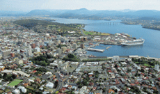 Hobart,
the State’s capital in southern Tasmania, has a large
international airport a short drive from the city centre.
It is gateway to the historic Port Arthur, and the southern
wilderness areas. Hobart,
the State’s capital in southern Tasmania, has a large
international airport a short drive from the city centre.
It is gateway to the historic Port Arthur, and the southern
wilderness areas.
The capital, Hobart, is in the south of the island
at latitude 42.5 degrees south. Maximum temperatures
in winter average 12 degrees C, and in summer average
21.5 degrees C. The mild temperate climate make the
summer months ideal for outdoor activity. Tasmania operates
under Australian Eastern Standard time. Hobart is on
the Derwent river, has one of the world's finest deep
water harbours and the majestic Mt Wellington in the
background. The population of the Hobart metropolitan
area is 194,000.
Hobart Airport, located just 17 kilometres from Australia's
southern most capital city, provides an international
gateway to the island State's famous heritage. www.hobartairpt.com.au/
Tasmania holds a lot of heritage and culture with a
number of spectacular buildings to see in Hobart. Macquarie
Street hosts some splendid Georgian buildings, and the
Theatre Royal on Campell Street is the oldest theatre
in Australia. Runnymede in New Town also hosts some
colonial buildings ranging from the 1830's, open everyday
10.00am - 4.20pm. It is also worth taking a look at
Parliament House and nearby St. Davids Park, as well
as the Royal Tasmanian Botanic Gardens next to Tasman
Bridge.
You can also visit Cascade Brewery, Australia's oldest
brewery, and join the tour at 9.30am or 1.00pm. Hobart
offers lively entertainment and often bands in the evening,
with the main areas to go out being Elizabeth Street,
Salamanca Place and Sandy Bay. There are a number of
Hobart tours
and things to do and places to visit you can join
in Tasmania both by bus or by ferry depending on what
you want to see. There are a range of museums in Hobart
including the Allport Library and Museum of Fine Arts,
the State Library hosting a number of rare books, the
Lady Franklin Gallery, Moorilla Museum of Antiques,
the Maritime Museum of Tasmania giving the history of
Hobart's Shipping industry and the Tasmanian Transport
Museum.
Events in hobart vary from The Hobart Christmas Pageant
will be held on Saturday 17 November, 2007 commencing
at 10.30am and concluding at approximately 12 noon.
The Hobart Christmas Pageant is a popular tradition
that delights adults and children alike year after year.
Not only do thousands of spectators take pleasure in
viewing the procession, but the entrants themselves
enjoy being part of the largest event of it's kind in
Tasmania.
Then we have the Hobart Summer Festival. Another very
successful Hobart Summer Festival was held over eleven
days in 2006/2007, commencing with the iconic food and
beverage event - The Taste - on 28 December. During
the Festival, Sullivans Cove precinct came alive, showcasing
the very best street theatre, live music and performance
for both the young and young at heart, and of course
some of Tasmania's finest food, wines, beers and other
beverages. For seven perfect sunny days, The Taste shone
as the only location to be on Hobart's waterfront.
 For
the flora lovers we have The City of Hobart Floral Shows
are a series of Spring and Autumn shows presented by
various local horticultural societies in conjunction
with the Hobart City Council. The program of displays
include the Dahlia & Gladiolus, Chrysanthemum, Daffodil
& Camellia, Orchid, Rhododendron, and the Rose & Iris
shows. The Australian Plants Society conducts a show
in the City Hall every two years. To compliment the
magnificent floral displays the various horticultural
societies conduct raffles, stalls selling plants and
cut flowers and provide information on plant growing.
City
of Hobart Floral Shows Dates - http://www.hobartcity.com.au For
the flora lovers we have The City of Hobart Floral Shows
are a series of Spring and Autumn shows presented by
various local horticultural societies in conjunction
with the Hobart City Council. The program of displays
include the Dahlia & Gladiolus, Chrysanthemum, Daffodil
& Camellia, Orchid, Rhododendron, and the Rose & Iris
shows. The Australian Plants Society conducts a show
in the City Hall every two years. To compliment the
magnificent floral displays the various horticultural
societies conduct raffles, stalls selling plants and
cut flowers and provide information on plant growing.
City
of Hobart Floral Shows Dates - http://www.hobartcity.com.au
Australian Golf Heritage Festival — May 24-29th, 2007
in Tasmania, home of Australia's oldest golf course
at Highland Lakes Road Bothwell is hosting a mix of
history tours, social and championship golf, & fine
wining and dining, in aid of local golf charities.
Also why not look at the ROYAL HOBART REGATTA usually
in February at http://www.royalhobartregatta.com/
and see where the entire Derwent River is given over
to the Regatta for the three days.
For those missing their cutural bust remember the Theatre
Royal at 29 Campbell Street, Hobart. The Box Office:
03 6233 2299 http://www.theatreroyal.com.au/.
For a day out visit the Hobart Zoo and catch up on
the now extinct Tasmanian
Tiger - http://www.parks.tas.gov.au/
Farther down to the southof Hobart are the ever reaching
forests around Geeveston. For a unique understanding
of this timeless landscape, why not stroll through the
canopy of the mature treed forest on the 'Tahune Forest
AirWalk', some 50 metres above the confluence of the
Huon and Picton Rivers. On your way back to Hobart consider
to visit the Huon Valley Mushrooms to see white, honey
brown, oyster and shiitake mushroom production.
Salamanca
Place Hobart in Tasmania
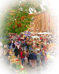
Salamanca Market
is held in Hobart every Saturday between 8.30am and
3pm – rain, hail or shine. Being Hobart’s popular outdoor
market you can join the locals for a shopping experience
with a difference. Salamanca Market is a special place
where you actually meet the people who create, make
or grow what they sell. You can shop here for locally
grown organic fruit and vegetables, freshly cut flowers,
fine Tasmanian arts and crafts and an array of odds
and ends.
 Once
the haunt of workmen, sailers and even whalers the old
Georgian buildings and warehouses that line Salamanca
Place with lots of artie shops and trendy restaurants
in a row of meticulously perfectly refurbished dated
sandstone warehouses are today Hobart’s cultural hub;
home to galleries, theatres, cafes, craft shops and
restaurants. Once
the haunt of workmen, sailers and even whalers the old
Georgian buildings and warehouses that line Salamanca
Place with lots of artie shops and trendy restaurants
in a row of meticulously perfectly refurbished dated
sandstone warehouses are today Hobart’s cultural hub;
home to galleries, theatres, cafes, craft shops and
restaurants.
Salamanca Market
operates every Saturday from 0830 until 1500. Try getting
there early to park that camper or motorhome and really
have a few hours to enjoy yourself. Salamanca Market
is rather close to historic St David's Park which is
on the fringe of Hobart's central business district,
where many city shops are open Saturday.
From the market
take a short climb up the Kelly's Steps to reach the
Georgian Cottages and the village atmosphere of Battery
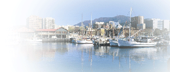
Point. Hobart's picturesque and famous waterfront is
also nearby across the Salamanca grassed lawns to Constitution
Dock, where hard-working fishing
boats are berthed close to cruising yachts and a square-rigger
or two. Visit at New Year and see the finish of the
famous Sydney to Hobart Yacht Race. The Rolex
Sydney Hobart is a 628nm yacht race which begins in
Sydney Harbour and finishes in Hobart. Each December
on Boxing Day you can see the world's greatest yachts
charging through Sydney Heads as they take part in the
Rolex Sydney Hobart Yacht Race. Days later, in Hobart,
the excitement builds as news of who will be the first
boat to arrive comes through to Constitution Dock in
Hobart.www.salamanca.com.au
Port
Arthur in Tasmania
Port Arthur has become one of Tasmania's
most prominent tourist destinations. The drive from
Hobart to Port Arthur takes approximately 1.5 hours.
Port Arthur is 95km (60 miles) south-east of Hobart
on the Tasman Peninsula. From Hobart, take the Tasman
Highway to Sorell and then the Arthur Highway. Though,
it may take longer if you take time to enjoy the scenery
and stop to view the attractions along the way.
The cruise from Hobart to Port Arthur
aboard the MV Marana takes approximately 2.5 hours.
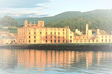 Port
Arthur is one of Australia's great tourism destinations.
Every building, every feature of Port Arthur Historic
Site has a story to tell. The Port Arthur Historic Site
encompasses a total of more than 100 hectares. About
40 hectares of the Site is accessible to the public,
including more than 30 buildings, ruins and restored
period houses. Created with convict labour, the impressive
architecture, delightful gardens and chilling prison
facilities survive today for you to explore. Today visitors
walk its paths and view stabilised ruins and carefully
restored buildings, experiencing how once it must have
been when Port Arthur was a hell on earth as one of
England's most notorious convict settlements. www.portarthur.org.au/
and for the Port
Arthur Caravan and Cabin Park at Port Arthur. Port
Arthur is one of Australia's great tourism destinations.
Every building, every feature of Port Arthur Historic
Site has a story to tell. The Port Arthur Historic Site
encompasses a total of more than 100 hectares. About
40 hectares of the Site is accessible to the public,
including more than 30 buildings, ruins and restored
period houses. Created with convict labour, the impressive
architecture, delightful gardens and chilling prison
facilities survive today for you to explore. Today visitors
walk its paths and view stabilised ruins and carefully
restored buildings, experiencing how once it must have
been when Port Arthur was a hell on earth as one of
England's most notorious convict settlements. www.portarthur.org.au/
and for the Port
Arthur Caravan and Cabin Park at Port Arthur.
There are guided tours of the area,
which are a good way to cover the site in an orderly
fashion. As well, there is the Historic Ghost Tour which
is held after nightfall when the dark covers the land
and the ghosts of the past may just be about.
Port Arthur is located on the Tasman
Peninsula and is the best preserved convict penal colony
in Australia and the most visited place in Tasmania.
More than 20 000 people a year wander through the old
sandstone remains. Isolated by a narrow strip of land
called Eaglehawk neck and a magnificently rugged coastline,
it made an ideal location for a penal colony. Port Arthur
was home to 12 000 convicts, both men and boys between
1830 and 1877. Tales of infamy and cruel inhumanity
abound.
Richmond
in Tasmania
Come and take a step back in time and engulf yourself
in what it was life in the early life of a Tasmanian
and visit Australia's most delightful Georgian village
24kms from Hobart. Richmond is on Tasmania’s
Convict Trail. The village was once a key military post
and convict station, between Hobart and the infamous
Port Arthur penal settlement it was strategically located.
Richmond’s convict buildings even predate the Port Arthur
Settlement.
 Richmond
is a genuine village of slate and cobbles, handmade
brick and mellow stone, cottages and manors. Richmond
is a genuine village of slate and cobbles, handmade
brick and mellow stone, cottages and manors.
Wander streets lined with sandstone
buildings that now serve as showplaces for antiques
and Tasmanian arts and crafts.
With it's tearooms serving days of
past Devonshire teas and all kinds of food delicacies,
old fashioned sweets and baked delights.
On the way back from Richmond, detour
past the airport to Barilla Bay Oysters for fresh shellfish
and there are tours available. Have lunch and taste
them at the Barilla restaurant.
Bruny Island
in Tasmania
The Island is situated approx. 30km
south of Hobart, and is separated from the mainland
of Tasmania by the D'Entrecasteaux Channel. Bruny Island
actually comprised of 2 parts that being South Bruny
and North Bruny which are connected by a narrow strip
of land called the ‘Neck'. Bruny Island is about 50
km long. Apart from Adventure Bay, the island's other
tiny settlements are Lunawanna and Alonnah.
Bruny Island has approximately 600 permanent residents
and up to 2000 folks can be there in summer.
Bruny Island really is a place of
actual unspoilt natural beauty. Its eastern coastline
has panoramically spectacular views along with a lenghty
stretch of wide sandy beaches. The Bruny Island Surf
Classic is held each year in February.
Today Bruny Island has become a popular
day trip from Hobart. It is only 37 km via the A6 to
Kettering a smallish town on the Tasmanian mainland
where the vehicle ferry to Roberts Point on North Bruny
departs app. ten times a day, eleven on Friday and eight
times on Sundays.
The Island has an number of flora
and fauna including wallabies and kangaroos aloong with
a large number of species of rare birds.
Bed and Breakfast's - There
are 10+ smaller Bed and Breakfast's scattered around
along with a few campsites. Sanctuary 87 Main Rd Dennes
Point Bruny Island TAS 7150 Telephone: (03) 6260 6260
and Swanhaven Bruny Island Bruny Island TAS 7150 Telephone:
(03) 6260 6428 Email: swanonbruny@bigpond.com
Cottages - Cloudy Bay Cabin
Cloudy Bay Bruny Island TAS 7150 Telephone: (03) 6293
1171 or The Explorers' Cottages Lighthouse Rd Lunawanna
Bruny Island TAS 7150 Telephone: (03) 6293 1271 Email:
brunyexp@tassie.net.au
Apartments - are at Inala
Country Apt Cloudy Bay Rd Lunawanna Bruny Island TAS
7150 Telephone: (03) 6293 1217 or Whaler¹s Inn Holiday
Village Apts Lighthouse Rd Lunawanna Bruny Island TAS
7150 Telephone: (03) 6293 1271
Caravan Parks and Camp Grounds
-
On the Tasmanian mainland close by
is Snug Beach Cabin and Caravan Park - Holiday Accommodation
- Tasmania! Ideally situated close to attractions like
Bruny Island and the Huon Valley and only 20 minutes
from Hobart! 35 Beach Road Snug - Tasmania 7054 Australia
Ph: 03 6267 9138, Fax: 03 6267 9128
Things to do, places to see and
visit and attractions on North Bruny and South Bruny
in Tasmania are - Adventure Bay Road runs off the
Main Road, following the coast past Adventure Bay to
East Cove, at the north-eastern end of the South Island.
Further along the Adventure Bay Road is another turnoff
into Lockleys Road. Follow Lockleys Road then turn into
Resolution Road past the signposted start of The Mavista
Nature Walk. This easy 30-minute walk that travels through
the greened rainforest and ferned glade adjacent the
beautiful Water Fall Creek. Adventure Bay Road ends
at a carpark at East Cove (information board here) and
then along the beach is the start of the coastal track
to Grassy Point some 1 1/2 to 2 hours return.
Other Walks that can be taken are
at the southern end of the stretch of 'North' Bruny
Island being The Cape Queen Elizabeth Walk which is
approx. 3-4 hours which leads off the Main Road out
towards the coast, then past Big Lagoon, Little Lagoon,
coastal heathland settings and relaxing views.
At the south west point of the 'South'
Bruny Island to north of Cape Bruny is The Labillardiere
Peninsula. Old Jetty Road being to the start of the
Luggobine Circuit walk a moderate to medium walk being
some 1/1/2 to 2 hours return and then the longer and
very tiresome and demanding Labillardiere Peninsula
Walk around 7-9 hours to return. This takes in the beaches,
scrub lands, heathlands, forests, Mount Bleak, rugged
coastline and it's coastal views including that of Partridge
Island. The East Cloudy Head Walk a tiresome and weary
(actually demanding) 4 hour walk takes in scenic views
and it's surrounding heathlands .
Launceston in
Tasmania
Launceston is one of Tasmania’s three main cities and
is the second largest city and is the North of Tasmania.
Launceston has a large airport with daily flights connecting
with Melbourne and other major Australian cities. The
state-managed national park system stretches from Flinder’s
Island off Tasmania’s northern tip to Melaleuca in the
far south west and to Rocky Cape
on the north west tip.
Whilst in Launceston rejuvenate
at the Aquarius Roman Baths, with a full therapeutic
Roman bath treatment including the hot waters of the
Caldarium and the warm Tepidarium.
Take an day out and visit Cataract
Gorge witnessing a wilderness backdrop stage on Launceston’s
doorstep.
West Coast in
Tasmania
Much of the West Coast is unexplored
wilderness, with densely treed rainforests, valleys
of unusal scrubland, wild white water rivers with pristine
and spectacular rapids and ravines. In the highlands
of the Lake country where some of the rivers have been
harnessed with new lakes created for the huge hydro-electric
schemes.
Rosbery
- Montezuma Falls in
Tasmania
Montezuma Falls - Duration
3 hour return - Grade Easy, level track suitable for
all age groups. Follow the signs to Williamsford and
Montezuma Falls 2km south of Rosebery on the
Murchison Highway (A10An easy walk, through rainforest,
along the route of the historic North East Dundas Tramway.
At 104m, Montezuma Falls are one of the highest waterfalls
in Tasmania and the track takes you right to the base
of the falls.
Davenport in
Tasmania
Devonport's seafaring connection with the mainland
continues now today through the Spirit of Tasmania,
the only passenger ferry operating across Bass Strait.
Spirit of Tasmania operates between Melbourne and Devonport,
sailing from both locations most nights and some days
during peak periods. Campervans and motorhomes fares
can be seen at http://www.spiritoftasmania.com.au
Devonport with a population of 24,000 is the largest
city on Tasmania's north-west coast, is approximately
one hours drive from Launceston.
Tiagarra, the Tasmanian Aboriginal
Cultural and Arts Centre, has dioramas showing the
lifestyle of the Tasmanian Aborigines from the region,
and is close to Aboriginal rock carvings. "Tiagarra"
means "keep" in the Tasmanian Aboriginal language. The
Tasmanian Aboriginal Cultural and Arts Centre is at
Mersey Bluff Devonport 7310 or at tiagarra@southcom.com.au
Leaving from Devonport Chocolate
lovers shouldn’t miss the House of Anvers at Latrobe,
with its chocolate factory and museum producing
hand-made, Belgian-style chocolate truffles, fudges
and pralines.
Ashgrove Farm Cheese specialize in the production
of award winning English Country style cheeses using
traditional recipes and manufacturing techniques. The
cheese is manufactured from milk produced on the farm
by the 800 cow dairy herd ensuring the highest quality
standards are maintained throughout the process. Ashgrove
Cheese is located in picturesque Elizabeth Town, the
cheese factory is on the Bass Highway 20 minutes from
Devonport and 10 minutes from Deloraine. Visitors can
view the cheese making area and sample the range of
cheeses available. www.ashgrovecheese.com.au/
The
Davenport Hotel - http://www.thedavenporthotel.com/
is a great choice for the first nights stop over.
Cradle
Mountain - Lake St Clair National Park in Tasmania
 From
Hobart drive some 375km east towards Strahan
situated on Tasmania's west coast. On the way stop in
and take a Gordon
River Cruise www.gordonrivercruises.com.au/ (pre
booking recommended) which takes you through the narrow
and turbulent Hells Gates the entrance to the harbor,
past Brown Trout fish farms and on to Sarah Island with
it's history of perhaps the most notorious of all penal
settlements. From
Hobart drive some 375km east towards Strahan
situated on Tasmania's west coast. On the way stop in
and take a Gordon
River Cruise www.gordonrivercruises.com.au/ (pre
booking recommended) which takes you through the narrow
and turbulent Hells Gates the entrance to the harbor,
past Brown Trout fish farms and on to Sarah Island with
it's history of perhaps the most notorious of all penal
settlements.
With stretches
of lush open countryside, eucalyptus and myrtle forests
along with the occasional small quaint and rustic town
or homestead. As your driving you will see the mountains
looming in the distance. Leaving this landscape it's
only about 26 miles from Queenstown to Strahan. Travelling
from Strahan to Cradle Mountain being a distance of
155km and the driving time is 1 hour 45 mins by then
Hobart is 4 hours via the Midlands highway.
At the Gateway
to Cradle Mountain is also Cradle
Chalet - http://www.cradlechalet.com.au/. Cradle
Chalet features 4.5 star accommodation and dining on
the edge of Tasmania's tranquil Cradle Mountain wilderness
and is renowned for combining the natural beauty of
the area with the intimacy, privacy and personal touch
of a boutique luxury lodge
The
Cradle Mountain Lodge - http://www.cradlemountainlodge.com.au/
is a unique wilderness retreat on the edge of the World
Heritage Listed Cradle Mountain/Lake St. Clair National
Park. For guests of Cradle Mountain Lodge, it is not
necessary to venture into the National Park to experience
the best of Tasmania's wilderness, as The Cradle Mountain
Lodge have a host of great walks with spectacular scenery
that leave directly from the Lodge grounds. There are
over 20 walks to choose from directly around the Lodge
http://www.cradlemountainlodge.com.au/.
Combine a motorhome hire and a
night at Cradle
Mountain Lodge for some relaxing indoor pampering. Cradle
Mountain Lodge is located 81km
from Devonport (1¼ hrs), 110km from Burnie (1½
hrs), 142km from Launceston (2½ hrs) and 375km from
Hobart (4½ hrs). Allow additional travelling time during
adverse conditions.
Campervan and Motorhome rental is
available through www.tasmaniamotorhomes.comt from Launceston
(drive time is approx. 2.5 hours) Hobart (approx.4.5
hours) and Devonport (approx. 1 hour and 15 minutes).
If you wish to camp at Cradle
Mountain a few suggestions to look at are
Cosy Cabins Cradle Mountain which has Powered Caravan
Sites and Camp Sites and is situated on the edge of
the world renowned Cradle Mountain - Lake St. Clair
National Park & World Heritage area.The park has established
powered sites for motor campers, small pop tops and
caravans. http://www.cosycabins.com.au/.
Or The Cradle Mountain Tourist Park Ph
(03) 6492 1395 and bookings are essential.
GUIDED WALKS,
SELF-GUIDED WALKS AND STROLLS
The area is a "sub alpine" zone and
can be cold and snowy at any time of the year. It has
only 32 sunny days a year. So choose your dates and
clothes well. Despite the dismal weather this place
was teeming with wildlife.
When out walking
it is recommended that you do not wander off the tracks
and that you wear sensible, comfortable shoes or sneakers.
You should also take warm clothes and/or wet weather
gear, hat, sunscreen and sunglasses with you, as the
weather is unpredictable in this alpine region. For
environmental and safety reasons, we ask that you stay
on formed tracks at all times.
*Denotes
that Guided Walks along these tracks are also available
- charges apply. Additional information and detailed
walking maps are also available from the Cradle Mountain
Visitors Centre.
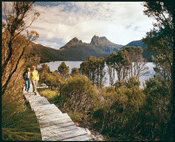 Dove
Lake Cicuit Walk - Duration 3 Hours - Grade Easy.
This 6km track is one of Tasmania’s premier walks. It
will take you right around Dove Lake and beneath the
towering spires of Cradle Mountain. The track is boardwalked
for much of the way. It is located in Cradle Mountain
- Lake St Clair National Park. Picnic and toilet facilities
nearby. Dove
Lake Cicuit Walk - Duration 3 Hours - Grade Easy.
This 6km track is one of Tasmania’s premier walks. It
will take you right around Dove Lake and beneath the
towering spires of Cradle Mountain. The track is boardwalked
for much of the way. It is located in Cradle Mountain
- Lake St Clair National Park. Picnic and toilet facilities
nearby.
Cradle Valley Board Walk: Cradle Mountain
Visitor Centre to Dove Lake, about 2.75 hours in total.
The walk can be divided into three sections; Visitor
Centre to Snake Hill (1 hour), Snake Hill to Ronny Creek
(45 minutes) and Ronny Creek to Dove Lake visa Lake
Lilla (1 hour).
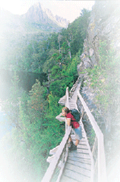 The
Enchanted Stroll* -Duration 20 Minutes (1km) -Grade
Easy (for ages 0 to 90 plus) -Starts The front of the
Main Lodge (circular track) A walk to suit all age groups.
For company there’s a cascading river, wombat burrows
and magical old-growth rainforest. The walk is located
in Cradle Mountain - Lake St Clair National Park. Highlights
The walk will take you through butongrass moorland before
entering cool temperate rainforest along the edges of
Pencil Pine Creek. Keep you eyes out for the wombat
burrows on the Lodge side of the creek. 1 hour from
Sheffield; 1.25 hours from Devonport The
Enchanted Stroll* -Duration 20 Minutes (1km) -Grade
Easy (for ages 0 to 90 plus) -Starts The front of the
Main Lodge (circular track) A walk to suit all age groups.
For company there’s a cascading river, wombat burrows
and magical old-growth rainforest. The walk is located
in Cradle Mountain - Lake St Clair National Park. Highlights
The walk will take you through butongrass moorland before
entering cool temperate rainforest along the edges of
Pencil Pine Creek. Keep you eyes out for the wombat
burrows on the Lodge side of the creek. 1 hour from
Sheffield; 1.25 hours from Devonport
King Billy Track* - Duration
40 Minutes (2km) -Grade Easy -Starts To the right of
the Main Lodge (circular track)
The Waterfalls Walk (Pencil Pine
Falls and Knyvet Falls)* - Duration 30-40 minutes
(1.5km) - Grade Easy- Starts Opposite Voyages Cradle
Mountain Lodge Boutique.
Speeler Track - Duration 1.5
Hours- Grade Medium -Starts To the right of the Main
Lodge (circular track)
Dove Canyon Track - Duration
3 Hours -Grade Hard -Starts Opposite the Cradle Mountain
Boutique (circular track).
Waldheim Forest Walk - Often
it is said a local guide will recommend the Waldheim
Forest Walk a short 15 minute trek through some of the
thickest moss and lichen forest that you will ever experience
and it's some what mystical. Not trekked by many and
I don't know why.
Take a night or 2 out and why not
stay at Cradle Mountain Lodge where they have a daily
program of guided walks which are recommended either
as an introduction to the area or as a guided adventure
to some of the more spectacular peaks. All guided tours
start at the main Cradle Mountain Lodge and transport
into the National Park is provided where applicable.
The duration of the walk may range from 20 minutes to
8 hours. Bookings are essential and can be made at Reception.
* Not all walks are offered each day. (With
courtesy of Cradle Mountain Lodge - http://www.cradlemountainlodge.com.au)
Dove Lake Trek - The Dove Lake
trek suggested to start out going to the right – the
opposite the recommended direction. Iif you follow the
recommended route you will encounter the hardest part
the last half hour when you are tired. Going in reverse
allows you to walk the hard part when you have the most
energy.
Crater Lake Circuit - Duration
3 Hours Grade Moderate. to Medium Suitable for family
groups. This track is at a lower altitude than many
other tracks in the Cradle Mountain area. It’s a better
option for days when the higher altitude tracks are
being lashed by cold winds and heavy rain.
Cradle Mountain Summit - Duration
8 hours return walk -Grade Difficult. 600m climb; walk
includes crossing large rocks. The walk is located in
Cradle Mountain - Lake St Clair National Park. The
main track to Cradle Mountain summit leaves from Dove
Lake and goes via Lake Lilla and Marions Lookout. However,
walkers have a choice of several tracks and can choose
to walk a different track on their return trip. Time
of day, weather conditions and fitness of party should
be kept in mind when choosing tracks for the trip. If
in doubt, check with staff at the visitor centre. Track
starts at 900m and climbs to 1545m. Highland weather
conditions can change quickly and frequently.
Pencil Pine Falls and Rainforest
Walk - A 20 minute circuit walk around Cradle Mountain
Visitor Centre
Huon Valley in Tasmania
The Huon Valley is the region which
gave Tasmania its name – “The Apple Isle. The Huon Valley
Apple and Heritage Museum should by phoned first to
check if it's open on Huon Hwy, Grove (Tel 036 266 4345)
You should also stop off at some of
the roadside stores and tables to sample the local produce
including it's name sake the delicous apple.
Ross in
Tasmania
Ross is located between Hobart and Launceston. Ross
is a beautiful colonial heritage town in the heart of
Tasmania’s world-renowned wool-growing area, which has
on many occasions held the world-record price for a
bale of superfine Merino wool.
Displays in the Tasmanian
Wool Centre’s Heritage Museum and Wool Exhibition -
www.taswoolcentre.com.au include samples of superfine
wool cloth together with other interesting features
of a bygone era. Enjoy yourself in the Heritage Museum
and Wool Exhibition on your self-guided tour. Then why
not look through the quality woollen merchandise on
sale there.
Strahan in Tasmania
Set on a quiet bay of Macquarie Harbour,
Strahan population of 900 is a picturesque Tasmanian
waterfront holiday town and also a working fishing port
Strahan is a seafood lovers haven. Strahan is the major
harbour town on Tasmania’s wild west coast, and a excellent
town to go to if you want to explore the wild and beautiful
World Heritage Area.
Things to do around Strahan - travel
on the West Coast Wilderness Railway. A scenic train
journey between Strahan and Queenstown through massive
hand cut rock cuttings, stunning rainforests and along
the edge of plunginging gorges. Recently awarded national
tourism awards this is one of Tasmanias premier tourist
attractions.In addition to the stunning scenery, the
journey gives visitors a great insight into the Pioneers
who built the railway.
From Strahan why not take a leisurely
cruise across the 50 kilometre (31 mile) length of the
Macquarie Harbour and along the tranquil wide Gordon
River. Gordon River Cruises - Esplanade, Strahan
- The small fishing community of Strahan on the West
Coast is remote and wild, just as you'd expect from
a place at the gateway to the Tasmanian Wilderness World
Heritage Area. The heart of the village faces the busy
waterfront from where the Lady Jane Franklin 11 departs.
How could any visit to Tasmania be complete without
a cruise on the world-famous Gordon River? The fight
to save this natural treasure in the early 1980's attracted
international attention and support. It's not hard to
understand why. The Macquarie Harbour: more than 110
square miles of natural, protected water surrounding
the crumbling history of Sarah Island. www.gordonrivercruises.com.au/
From Strahan you can also board a
seaplane to look over the lanscape from above on some
of the remaining 1,000-year-old Huon pine and myrtle
trees. You can join a tour and kayak the rapids or slow
moving rivers and waterways, jet boat along the King
River, walk the long openess of the Ocean Beach and
sand dunes.
If your driving from Cradle Mountan
and continuing west and south towards Strahan, via Zeehan
then please note road may be really steep and it somewhat
challenging at times.
Strahan Visitor Centre is at The Esplanade,
Strahan Tel: (03) 6471 7622 or email at strahan@tasvisinfo.com.au.
Accommodation choices can be found
at the website
Bicheno in Tasmania
Drive across the Island to Bicheno
through Ross and beautiful bridges of Richmond Bridge
and the Ross Bridge. Bicheno a small town with beautiful
beaches and penguins agalore. When there maybe stay
at the Old Tram Bed and Breakfast located on the bay
within walking distance of the penguins and blowhole.
Sign up for the official Penguin Tour
at the Bicheno Dive Centre - Ph: 03 6375 1138 which
is excellent and informative or Penguin Tours - Ph:
02 6375 1333 There are local nightly tours from the
surf centre. We recommend that you sign up as early
as possible as they do fill up and are limited in size.
However, if you miss out on the tour you can always
go down to the “blowhole” and stand quietly as the penguins
walk right past you. There's no charge for this but
please commonsense prevails by not scaring them, motioning
towards them, using a flash camera etc. The penguins
can be spotted all along the waterfront after sunset
and at times the little ones can make quite a racket
with their noise. They seem to nest in all sorts of
places under houses is one place.
Bicentennial foreshore walk -
from Redbill Beach to the Blowhole is just 3 km one
way and allow 2 hours for photo's and rest time.
Blowhole to Farm Point walk -
a walk along the Rice Pebble Beach past Muirs Rock towards
Farm Point. Then return via the track or Harveys Farm
Road. This is approx. 8 km return and allow 3-4 hours
for photo's and rest time.
Douglas Apsley National Park -
Located north of Bicheno, the park features wonderous
carved gorges and spectacular waterfalls. At Apsley
Gorge Lookout and Waterhole enjoy the breathtaking views
from the viewing platform above the Apsley River. Then
with time permitting walk down to the waterhole for
a (cold) dip/swim. This is a approx. 30 minute return
walk. Now at Apsley Gorge when the weather is kind to
you take time to enjoy undistrubed pools and quiet river
scenes. Allow 4-5 hours for photo's and rest time to
return.
Evercreech forest Reserve - Here
are reportedly the world's largest White Gums (Know
also as the Eucalypts) situated at Evercreech in the
Fingal Valley. Allow 4-5 hours for photo's and rest
time to return.
Governor Island Marine - Explore
and dive the wonders of the Governor Island Marine reserve
and see it's marine life. Governor Island Marine Nature
Reserve Rose Garden – The Rose Garden is a mass of broken
boulders covered with large sponges, seawhips, zoanthids
and jewelled anemones. Dive another site called The
Hairy Wall to see fi nger sponges in a spectacular setting.
But best of all… because this a marine reserve and a
‘no take’ area, see big old crays.
(Caution only dive with the dive shops - Bicheno Dive
Centre - Ph: 03 6375 1138)
East Coast Natureworld on Tasman
Hwy (Ph: 03 6375 1311) Relax by their lagoon pool and
enjoy the company of the friendly animals roaming around.
At Natureworld they host Tassie Devils, wombats
and much more.
Freycinet National Park - Only
35 minutes south east of Bicheno, that includes
Wineglass Bay.
Freycinet National Park - Only
45 minutes drive away to Swansea on the east coast.
Coles
Bay in Tasmania
Coles Bay in Tasmania sits at the
foot of the pink granite mountains known as the 'Hazards'
and on the edge of the world-renowned Freycinet National
Park about a two and 1/2 hours
scenic drive from Hobart and Launceston on the east
coast of Tasmania.
Coles Bay lies between red granite mountains and the
sheltered calm waters of 'Great Oyster Bay' on the rugged
and yet stunning Freycinet Peninsula. An experience
for true seafood lovers is to taste the oysters fresh
from the harvest on the Freycinet Oyster Farm tour.
Bookings are essential. Coles Bay to Swansea - 59 km
around 1 hour, Bicheno - 40 km around 45 minutes, St
Helens - 132 km around 2 hours.
Stop by Kate's
Berry Farm just 2km south of Swansea just 59 km to Coles
Bay- Swansea
Visitor Information Centre
Freycinet
& The East Coast (Includes Wineglass
Bay) in Tasmania
 Two
hours drive from Launceston is Freycinet along with
Wineglass Bay. Where else in Australia can one witness
pink granite mountains rising straight from the sea
to form a magnificent sheltered waterway or one of the
top ten Deserted beaches
in the world at Wineglass Bay? Two
hours drive from Launceston is Freycinet along with
Wineglass Bay. Where else in Australia can one witness
pink granite mountains rising straight from the sea
to form a magnificent sheltered waterway or one of the
top ten Deserted beaches
in the world at Wineglass Bay?
From Hobart
to Freycinet then you can considering head up the
Midlands Highway and enjoy morning tea at the small
township of Ross and look at the remants of the "female
factory", a work facility for female convicts. From
Campell Town one can take a minor road through Lake
Leake onto Freycinet. Lake Leake seem to have the cheapest
powered sites seen anywhereat $8 per night.
The park is about 2 1/2 to 3 hours
from either Hobart or Launceston. Turn off the Tasman
Highway (A3) (which runs down the east coast of Tasmania)
taking you alongside beaches and
tiny seaside towns onto the Coles Bay Road (C302)
12 km south of Bicheno. (The turnoff to the Friendly
Beaches section of the park is via a gravel road about
2 km after leaving the highway). The main park entrance
and visitor reception are just after Coles Bay township
about 30km from the highway on a good quality sealed
road.
Walk along the
powder white sand. Wineglass Bay beach was voted one
of the "Top 10 Deserted Beaches in the World" by Conde
Nast Traveller magazine. http://www.freycinetcolesbay.com/
Freycinet
National Park in Tasmania - http://www.parks.tas.gov.au/
- Frecyinet National
Park take 1-3 days to relax and explore the Rugged Granite
peaks and white sandy beaches of Freycinet National
Park. Your time here can be as energetic and relaxing
as you want it to be.
Freycinet National
Park also has some stunning walks including the 25-minute
climb to the viewing platform over Wine Glass Bay, regarded
as one of the most beautiful beaches in the world. Feel
free to explore the park by foot on any of the 7 great
short walks located in the park including the most celebrated
1 to 2 hour return walk to Wineglass Bay Lookout.
Accommodation
places in Coles Bay or Freycinet range from luxury accommodation
to budget accommodation and wilderness camping.
Freycinet Lodge - is Tasmania's
premier environmentally friendly resort having won many
awards and recommendations. The property has 60 tastefully
furnished cabins situated in a bushland setting, which
is located within Freycinet National Park - the home
of spectacular Wineglass Bay. Freycinet Lodge is conveniently
situated inside the park and is close to the beginning
of the walks. Visit http://www.freycinetlodge.com.au/
Pelican Bay Bed & Breakfast
is a traditional Bed and Breakfast a waterfront property
and it backs onto Pelican Bay, a small inlet on the
Swan River just near where it flows into Great Oyster
Bay. Set amongst a very tranquil half an acre of maintained
well-established l gardens that seem attract many native
birds and parrots and their songs. After a day experiencing
all the natural beauty of the Freycinet Coast just walk
out the thir back gate and try your luck at fishing
or stroll along the water's edge to Swanwick Beach for
a swim (can be chillie obviously in certain monts).
http://www.pelicanbaybedandbreakfast.com.au/
Aspect on Freycinet Bed and Breakfast
- is open November to May A beautifully appointed
waterfront B&B providing guests with views over Great
Oyster Bay to the stunning Hazards Mountains of the
Freycinet Peninsula – both enjoyed from your comfortable
Queen size bed. Location is 101 Esplanade, Coles Bay
7215. (Turn right after the Coles Bay town sign and
continue 900 metres along the Esplanade). Email: mhnjcooke@telstra.com
or Tel Nola & Michael Cooke on +61 (0) 407 273 377
Freycinet Bay Apartments -
Prestige Self-Contained Apartments Absolute beachfront
- ultra-modern minimalist design - exclusive, private,
self-contained, 5 star luxury - 2 Bedroom, 2 Bathroom,
stunning, new apartments. Phone: 0428 245336 or visit
Iluka Holiday Centre at Freycinet
National Park in Coles Bay, Tasmania - offers a
full range of accommodation and amenities including
a tavern, bakery, and shop. Self-contained units, onsite
vans, YHA backpackers hostel, powered & un-powered sites.
Visit
Freycinet
National Park - Camp Grounds at Richardsons
Beach, Honeymoon Bay and Ranger Creek - unpowered sites
and powered sites. (Important
- Conditions apply - scroll down to the Freycinet
National Park section ) as a ballot system operates
for the Christmas holiday period or email freycinet@parks.tas.gov.au
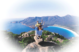 Wineglass
Bay Lookout - Freycinet National Park - Grade is
Difficult. Steep uphill climb over 1.3km with over 600
rough bush steps and the rigorous uphill walk is not
suited to those with health or mobility concerns. The
4km ride or walk (1 to 2 hours return) can be much steeper
than one expects and you will have to walk your bike
up the bigger hills.The walk into Wineglass Bay starts
with a really steep climb so you may decide to take
a less-steep but the longer return route back along
Hazard Beach. The total circuit/loop is around 11.5
kms. Take 2-3 litres of water per person at least. At
the head of the trail ther are toilet facilities at
car park. Picnic facilities nearby. Wineglass
Bay Lookout - Freycinet National Park - Grade is
Difficult. Steep uphill climb over 1.3km with over 600
rough bush steps and the rigorous uphill walk is not
suited to those with health or mobility concerns. The
4km ride or walk (1 to 2 hours return) can be much steeper
than one expects and you will have to walk your bike
up the bigger hills.The walk into Wineglass Bay starts
with a really steep climb so you may decide to take
a less-steep but the longer return route back along
Hazard Beach. The total circuit/loop is around 11.5
kms. Take 2-3 litres of water per person at least. At
the head of the trail ther are toilet facilities at
car park. Picnic facilities nearby.
The crystal clear waters and white
sandy beach of Wineglass Bay are a tremendous sight.
This is a steep uphill walk on a rocky, well-constructed
track within the Freycinet National Park.
Wineglas Bay - 2.5 hours return
from Wineglass Bay car park inside Freycinet National
Park. This walk in the Freycinet National Park follows
on from the walk to the Wineglass Bay lookout. Grade
- Difficult. Steep uphill climb over 1.3km with over
600 rough bush steps.
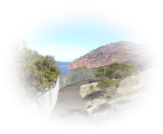 Cape
Tourville - 20 minute circuit walk. Grade is Easy
- the track is wide, with even surfaces and gently graded
slopes. It may suit wheelchair users, who have someone
to assist them, and walkers with strollers. The highlight
is the lighthouse at Cape Tourville. A boardwalk actually
clings below the cliff top. Around half way along the
track stone steps commence to proceed up to the lighthouse.
The Cape Tourville circuit is one of Tasmania's great
short walks. Cape
Tourville - 20 minute circuit walk. Grade is Easy
- the track is wide, with even surfaces and gently graded
slopes. It may suit wheelchair users, who have someone
to assist them, and walkers with strollers. The highlight
is the lighthouse at Cape Tourville. A boardwalk actually
clings below the cliff top. Around half way along the
track stone steps commence to proceed up to the lighthouse.
The Cape Tourville circuit is one of Tasmania's great
short walks.
There are memorial
views towards the north along Friendly Beaches across
to Butler's Point and then south across to Carp Bay
onto Sleepy and Wineglass Bays. Straight out at sea
are 'The Nuggets' being the residence to many migrating
squaking sea birds. Once inside Freycinet National Park,
follow the main road, then turn left onto the Cape Tourville
Road. (The 7km Cape Tourville road is unsealed but is
suitable for two-wheel drive vehicles.). Toilet, picnic
and electric barbecue facilities 7.5km away at Ranger
Creek and Honeymoon Bay.
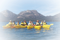 The
Freycinet Paddle is the ultimate way to experience Freycinet.
Kayaking with local guides and all the equipment is
supplied. Freycinet
Paddle and Adventures www.freycinetadventures.com.au The
Freycinet Paddle is the ultimate way to experience Freycinet.
Kayaking with local guides and all the equipment is
supplied. Freycinet
Paddle and Adventures www.freycinetadventures.com.au
Southern right, humpback, pilot and
on seldom occassions minke whales visit during the winter
months int he area. As with all wild animals sightings
never guaranteed, though if you consider climbing to
the Wineglass Bay Lookout in the early morning you may
be lucky and view whales. Freycinet
Coles Bay - http://www.freycinetcolesbay.com
Mt Field National Park in
Tasmania
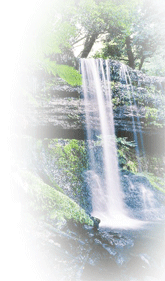 Mt
Field National Park - The Mt. Field National Park
is approximately an hour's drive past New Norfolk out
of Hobart some 80+ klm and 2 hours being a scenic drive
minutes drive northwest of Hobart on the Rivers Run
route or B61. Close to the Mt Field National Park entrance
are three main waterfalls being the Junee Falls, Marriotts
Falls, and the most popular and well-known Russell Falls
is one of Tasmania's most loved falls (insert). Mt
Field National Park - The Mt. Field National Park
is approximately an hour's drive past New Norfolk out
of Hobart some 80+ klm and 2 hours being a scenic drive
minutes drive northwest of Hobart on the Rivers Run
route or B61. Close to the Mt Field National Park entrance
are three main waterfalls being the Junee Falls, Marriotts
Falls, and the most popular and well-known Russell Falls
is one of Tasmania's most loved falls (insert).
The park itself is one of the prime
habitats for the famous Tasmanian Devil.
Some of the eucalypt trees in the
park are 90 metres high, 20 metres around the base and
over 400 years old, and . Mount Mawson, west of Lake
Dobson, may be known as one of Tasmania's best skifield
after Ben Lomond. It is covered with snow for approximately
4 months of each year, and chains will be needed at
times.
The park essentially has two visitor
sections. The first, near the park entrance, includes
picnic facilities and the famous Russell Falls. Enchanting
walkng trails through enormous fern forests and some
of the tallest trees in the world are available in this
area. The second visitor section is centred at Lake
Dobson and includes the longer day walks and skiing
areas.
For the latest snow reports during
the ski season, see .
Beautiful mountain scenery and alpine plant sflora species
are a feature of the higher parts of the park. Mt
Field National Park -http://www.parks.tas.gov.au.
The Visitor Information Centre near
the car park and adjacent to the path to Russell Falls
Lyrebird Nature Trail is a
walk from the car park at Mt Field National Park. Lyrebird
Nature Trail is located some 7klm up the Lake Dobson
road and off to the right passing kangaroo ferns, uniquel
heath species, yellow gums, ferns and sword grass.
Maydena is 13 km past The Mt. Field
National Park and at the beginning of the Gordon River
Road a toll road. The highlight is a huge mountain ash
'The Big Tree' which, at a height of 98.2 m,
is the largest eucalypt in Australia located in the
Styx Valley.
For information on Mt Field National
Park treks, hikes, trails and walks, or to register
for overnight hikes and/or to talk to the ranger Tel
03 6288 1149). Or drop in to the Mount Field Ranger
Station at the entrance to the park during opening times.
Mt Field National Park Camp Ground
- Mt Field 66 Lake Dobson Road Tel:+61
(0) 3 6288 1149 (We strongly suugest you phone well
in advance). No bookings are taken. Facilities include
amenities block, toilets, showers, hot water and basins.
Coin operated washing machine & dryer, rotary clothes
line. There is one coach site. Shelter with two free
electric bbq's and sink with hot water. Caravan access
is available.
Also available 3 cabins with 6 bunks
per cabin, with vinyl covered mattresses, cold water,
wood heater and firewood. No electricity/gas. Communal
toilet block (no showers). It is recommended that advance
bookings are made. - Mt Field 66 Lake Dobson Road Tel:03
6288 1149 (We strongly suugest you
phone well in advance).
Mount Field
has one youth hostel. Mt. Field National Park Youth
Hostel on Main Road, Mount Field National Park Tel:
+61 (0)6288 1369 and thier email is yhatas@yhatas.org.au
A rather peaceful area, the YHA hostel has a cosy atmosphere
and is just a few hundred metres away from the national
park entrance. Some meals and EFTPOS available at hotel
opposite the YHA.
National Park
Hotel offes basic ground-floor pub accommodation including
breakfasts, (the National Park Youth Hostel is opposite)
The pub has an EFTPOS facility, but the nearest fuel
is 7km further on at Westaway.
Bed
and Breakfasts in Tasmania -
at Swansea Find peace, warmth and welcome in this grand
Georgian Home. Six Queen sized rooms with ensuite.
Open Fire, Licensed, meals by arrangement, guest lounge,
60 metres from Schouten Beach.Located 1 Waterloo Rd
Swansea Tel +61 (0) 6257 8564.
Terrain
in Tasmania
Tasmania is
a rather mountainous island with almost half of the
State being 600 metres or more above sea level.
Four of Tasmania’s
highest mountains are located in the Cradle Mountain
- Lake St Clair National Park such as Cradle Mountain
at 1545m. There are 155 mountains in Tasmania and these
are above 1100 meters in height and Mount Wellington
overlooking Hobart ranks 76th highest.
Fishing in Tasmania
There
are over 3000 lakes, rivers and streams in Tasmania
so naturally it is an anglers paradise and regarded
as Australia’s premier wild trout fishing destination.
Salmon and trout were introduced
to Tasmania in 1864 although the salmon failed but the
brown trout thrived in the Tasmanian wilderness waterwyas.
A popular fishing lake is Lake
Barrington where brown trout, rainbow trout and even
black fish abound.
Lake Barrington being some 20
kilometres is located at the base of Forth River Valley
which is an an artificial lake that was created by the
construction of the 84 metre high Devils Gate Dam on
the Forth River for hydro-electric power production
in 1969.
Horse Riding in Tasmania
Embrace
on Tasmanian country on horsback through the Tasmanian
High Country with horse riding through areas where there
are bush tracks, quiet roads, horse trails and uncharted
bush. Well cared for horses and real Tasmanians to guide
you on these rides. Here are just but a few of the choices.
Silver Ridge - in Mountain & Lakes District 7
http://www.silverridgeretreat.com.au
or at Tel +61 (0) 3 6491 172, Strahan Trail Rides
- Strahan
or at Tel +61 (0) 3 6471 7426, Tullah Horseback Tours
- in the Tullah area at Tel +61 (0) 36473 4289.
The Overland Track in
Tasmania
The Overland
Track is Tasmania’s recognised by many as the most famous
walking experience in Tasmania and it is widely recognised
as one of the world’s great wilderness treks. It stretches
along some pristine wildness 80 kilometres over Tasmania’s
highland country through the Cradle Mountain - Lake
St. Clair National Park starting from Cradle Mountain.
The track
jpourney's through a various landscapes and ecosystems
from mystic rainforests, to spectacular countryside
containing rugged mountains outlines, deep forested
valleys and alpine moorlands to the button grass plains.
The walk
takes from between 6 – 8 days for the fit and agile.
There there are very basic huts along the way which
provide shelter. Some 4,000 visitors walk either the
full length or sections of the Overland Track each year
some. This walk has often been described as one of the
best wilderness experiences in the world.
|


